Thinking of Ukraine.

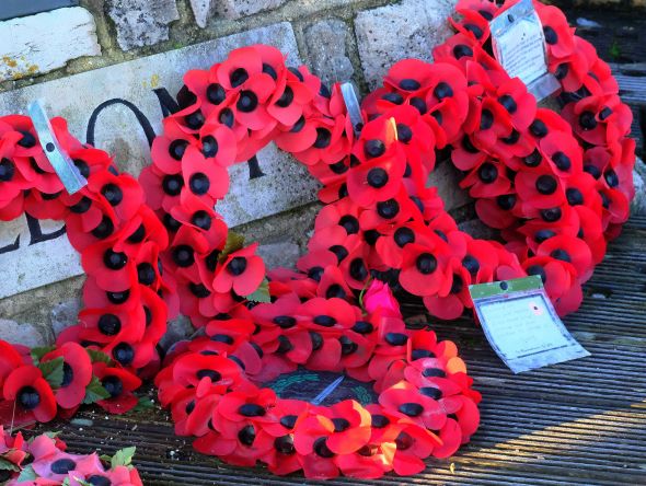
Thinking of Ukraine at this difficult time and hoping for peace.

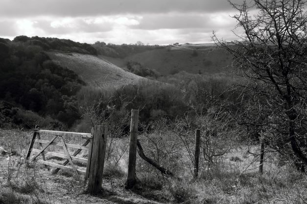
Back in 2014 on our 1st camper van tour of Scotland, we headed for the Lockerbie memorial garden the memorial to Pan Am Flight 103. On 21st December 1988 shortly after 19:00 while the aircraft was in flight over the Scottish town of Lockerbie, it was destroyed by a bomb that had been planted on board, killing all 243 passengers and 16 crew in what became known as the Lockerbie bombing. Large sections of the aircraft crashed in a residential street killing 11 residents.

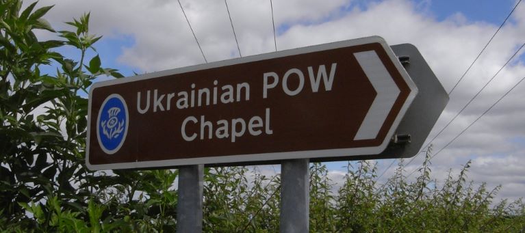
After leaving the town we saw a road sign to Ukrainian POW Chapel so we followed it to find out more. Away from the town were remains of a few huts (which numbered about 40 originally). One of these huts had been converted into a chapel by the prisoners.

Looking around it was all closed up, but before we left an old car turned up and an elderly gentleman turned up and unlocked the chapel.

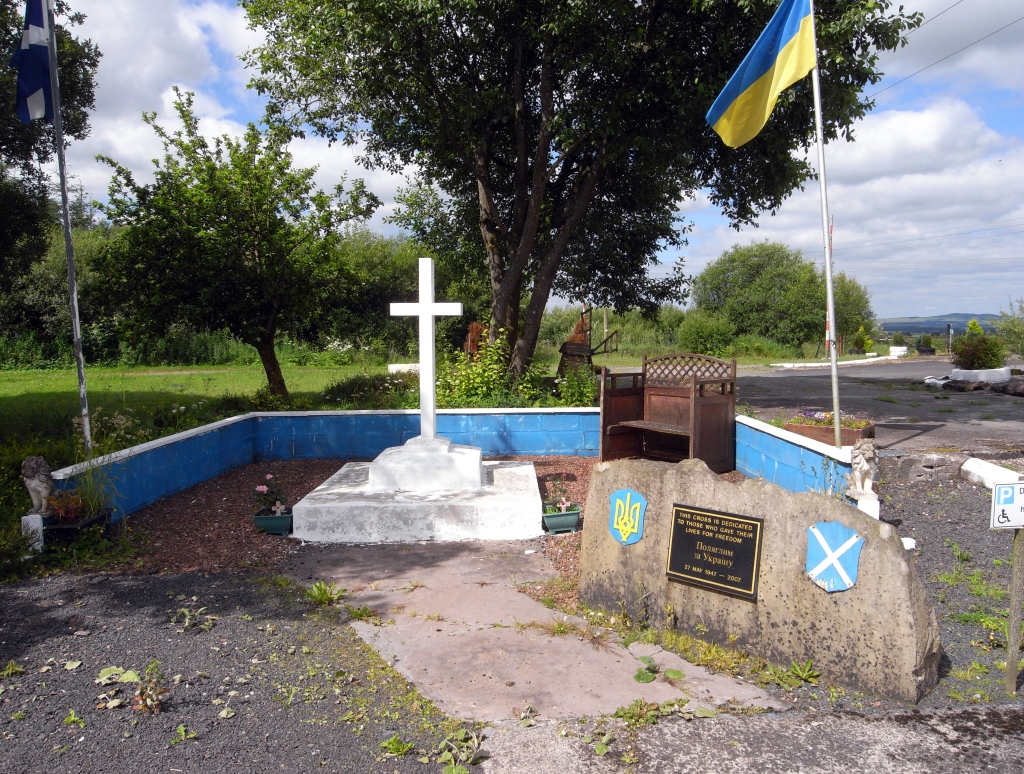
He told us that the camp held 400 Ukrainian prisoners of war who had fought with Germans on the Russian front against the Red Army. The hut that had been turned into a chapel was looked after by him. He also had a small museum in a caravan he took the time to tell us about the history of the camp. The prisoners left the camp during the day to work on local farms and return there at night. When the war ended the Russians occupied Ukraine. The prisoners could not return home as they would have been sent to the gulag or executed. The camp closed in 1947 and many prisoners had become part of the community. The man who looked after the chapel’s father was one of the prisoners and had married a local woman.

A few years later we visited again but the chapel was locked up. I was told with the failing health of the caretaker the chapel remained closed for a while.

Today looking online it appears services are still held at Hallmuir chapel on the first Sunday of each month and the building again is also used for marriages of members of the Ukrainian community.

The inside of this simple hut is ornate and reflects the Orthodox Catholic religion of the people who lived in the camp and built it.

A walk around my city.

A walk around Southampton this morning. The Town of Southampton became a city in 1964.

Parking up at Mayflower Park a short walk takes you into the old part of the town.

The view from the park is a great place to watch ship movement in and out of the port.

Just outside the park by the city wall is the Mayflower Memorial It commemorates the sailing of the Pilgrim Fathers to America in the Mayflower and Speedwell in 1620. The monument is a 50 ft high column of Portland Stone, surmounted by a cupola and a copper model of the Mayflower.

The old customs house and the Wool House which is is a medieval building which was built to serve the wool trade

Westgate from Westgate Street (inside the town wall looking out).

Old houses by the Westgate.

The Duke of Wellington pub in Bugle Street is a historic building with some old beams dating back to 1220.

Said to be Southampton’s most important historic building, Tudor House is now a museum. The timber-framed building in St Michael’s Square was built in the late 15th Century. King John’s Palace, an adjacent Norman house is accessible from Tudor House Garden, it dates back a further 300 years. 

Opposite Tudur House is St. Michael the Archangel Church it is said to be the oldest building still in use in the city. The spire was first built in the 15th century and then reconstructed in 1732. In 1887, to make it a better landmark for shipping, a further 9 ft was added to the blunt shape, It is now 165 ft.

Much of Southampton was devastated by the German bombing in WW2. Although the other churches in the central town, Holy Rood and All Saints, were both destroyed in 1940, St. Michael’s escaped with only minor damage. It is said the spire was used by the German bombers as a landmark and their pilots were ordered not to hit it.

The remains of Holy Rood Church now a merchant navy memorial

The church around 1900 before its destruction during the Blitz.

A victorian view of the city – note the church spires

Within the walls of Southampton was a castle but the site today is built on and only parts of the outer wall remain.

The Bargate is another gate to the old town.

Lions guard the gate into the old old town.
The Bargate (inside the town looking back).

Views from the old walls. In the sea in the past came up to the walls but the land now is reclaimed. The views included some nice Victorian House on the walls and the modern shopping centre.

Further away from the old town is an old Gasometer a listed structure but is under threat as the city wants the old gas works land to be redeveloped. A victorian structure to store coal gas. These structures once common in the UK are disappearing from the skyline quickly. These large containers in which coal gas was stored near atmospheric pressure at ambient temperatures. The volume of the container follows the quantity of stored gas, with pressure coming from the weight of a movable cap. As a child they fascinated me how the cap would move up and down. During the Blitz they were kept low due to the risks from bombing if they were hit when full.

An early picture of Gasmeter when full.

Before leaving my walk around the historic parts of the city I had to check if the Parrots were about and they were.

Ashlett Creek.

View towards Southampton Water.

Ashlett Creek is a tidal inlet on the New Forest side of Southampton Water near Fawley. The creek is only accessible at high tide. There has been a mill on the site dating back to medieval times. The mill is a Grade II listed building that was built in 1816 and milled corn until it closed around 1910. Ashlett mill was a tidal mill – a mill driven by tidal rise and fall. The tide comes in, it enters the mill pond through a one-way gate, and this gate closes automatically when the tide begins to fall. When the tide is low enough, the stored water can be released to turn the mill wheel. Flat bottomed sailing barges were used to load and unload grain, salt and other supplies. A Victorian Quay was built in 1887 to celebrate Queen Victoria’s Golden Jubilee.

The Mill.
Mill pond.

The Jolly Sailor, a 160-year-old pub is an old smuggler’s inn near the mill.

Birds in the Mill pond.

Further into the forest.

A return to the New Forest. We Parked up again at Eyeworth Pond – watching the pond with a cup of tea until the rain stopped before heading into the forest to the North-East following the track from the old Gunpowder Mills this road was built to allow the explosives to be transported away from the factory safely avoiding the small village of Fritham.

A little way along the track you pass a fenced spring. Known as “The Iron Wells” shown on maps dating back to the late-18th century. Marked on today’s Ordnance Survey maps as “Irons Well (Chalybeate)”. The water is impregnated with iron salts and is the colour of rust.

The waters are said to have curative properties particularly helpful for sore eyes, gout and other ailments, including leprosy. The spring was also known as Lepers’ Well, it is rumoured a house of rest for those suffering from leprosy was close to the well. Looking at the spring I decided not to take the waters on this visit!

No deer to see on our walk today.

.

Back at the pond lots of birds as always – but the Mandarin ducks steal the show with their bright colours there seemed to be 5 males and 3 females present again. – lots of photographs at the end of this post.

Male Blackbird.

Song Thrush.

Pied Wagtail.

A first for me today was a Brambling. Not the best picture of this female bird but given I have never seen one before I am happy with this attempt.

A Male House Sparrow.

On the way home, we spotted lots of Snow Drops an early sign of spring.

Eyeworth Pond.

A circular walk today in the New Forest starting and ending at Eyeworth pond.

History.

The pond was created by the Schultze Gunpowder Company as a reservoir to hold the water needed during the manufacturing process – it is estimated it held 6 million gallons of water. Work started on the factory in 1860. By the late 1890s the Company employed upwards of 100 people and there were some 60 buildings. The factory continued in operation under new ownership until 1921. The manufacturing of explosives deep in the forest away from the local population reduced the risk to the public. Today the reservoir remains although the factory has gone, it remains as a feature and wildlife habitat. Little other evidence of the factory survives, although the superintendent’s and gatekeeper’s houses remain and are private residences.

Birds. on the pond.

2 female Goosanders were on the far side of the pond ( I have seen males here as well in the past but not today). Goosanders are diving duck, they have long, serrated bills, used for catching fish. They 1st bred in the UK in 1871. ( These ducks are known as Common Merganser in the USA).

Mandarin ducks have for many years been a regular bird on Eyeworth pond. They always draw a crowd, they were introduced to the UK from China in the 20th century and have become established following escapes from captive collections. In the UK there are now said to be about 2,300 pairs and according to Wikipedia the population in China is only 1000 pairs.

Moorhen.

Woodland Birds. around the pond.

A woodland favourite is the Blue Tit.

Marsh Tit.

Great Tit.

Robin.

Dunnock

Dunnocks are also known as the ‘hedge sparrow’, although they are not actually a sparrow. They’re actually the only UK member of a bird family called the accentors. The dunnock is also commonly mistaken for a female house sparrow. Dunnock is derived from the Old English word for ‘little brown’. This is because they do look drab from a distance but close up they are quite pretty with a mottled blue-grey breast and face.

Deer.

Fallow deer are the most commonly seen deer in the New Forest currently numbers are maintained at about 1,300 Following the Norman Conquest of Britan ,the New Forest was proclaimed a royal forest, in about 1079, by William the Conqueror. Fallow deer were brought into the forest for the hunt. Forest Law, reserving the pursuit of beasts within it exclusively for the king and his officers.

Up the Hamble.

(Part 1 History). A walk today from Warsash up the river Hamble to Bursledon. About 2.5 miles each way on flat footpaths. The Hamble remains tidal on this stretch of the river.

From medieval times it has been a major ship and boat-building area. Many major boatyards were on this part of the river. Today it remains a yacht building area.

Many major ships were for the Royal Navy. Some details https://en.wikipedia.org/wiki/Category:Ships_built_on_the_River_Hamble

As the mature Oak was used much of the larger wooden shipbuilders relocated to the New Forest.

Warsash to Hamble ferry shelter. In the winter the passenger ferry only runs on weekends the shelters on each side of the river as well as the ferry are painted pink. You can see the boat coming!

As you walk along the river you pass many hulks and wrecks.

Many years ago I remember doing this walk when you had to pick your time to do it – making sure the tide was not too high as there were places where stepping stones were needed to be used to cross places where the water flowed into the marshes at the edge of the river. Now bridges ensure it is an easy walk for all.

Even a coffee break is now possible which many dog walkers were making use of.

Old bouys, and boat storage.

Artwork “bullrush” statues.

At the end of the walk is the old hamlet of Burseldon by the river it is a conservation area. There is a row of tiny cottages much extended at their rears – in the Napoleonic Wars with France, these were shipwright cottages.

Stoney Cross.

An early start in the New Forest with breakfast in the van before a frosty walk on the remains of Stoney Cross airfield.

Stoney Cross airfield was one of the larger wartime airfields within the forest. It was active between 1943 to 1946, It remained open after the war until it closed in 1948.

Stoney cross had three runways with the main runway, 2,000 yards (1829 metres) long. The second runway, was 1520 yards (1390 metres) and the shortest runway, at 1366 yards (1249 metres) long.

Sadly most of the concrete had been stripped from the runways by 2000 and used as hardcore in road construction. The outline of the runways can still be seen in places as well as remains of other concrete bases.

Parking at Cadmans Pool as a starting point to head off on foot across the site of the old airfield on Ocknell Plain. Apparently, the pond was dug around 1960 to enhance the aesthetic appeal of the plain.

On arriving today the pond was iced over at the temperature was -4, so a cold start.

A group of Fallow Deer strolling on the plain. There were some fairly handsome stags in this herd.

Away from the Stags in the wooded area were groups of young deer and females.

As usual, the trees around Cadmans Pool is a great place to observe and photograph small woodland birds.

Danebury Ring

A short walk at Danebury Ring Hillfort this morning. (location near Stockbridge Hampshire.) An Iron age hill with evidence suggesting that the Fort was built 2500 years ago and occupied for nearly 500 years until the arrival of the Romans in Britain.

Today a plateau at the top of the hill remains it was once the site of a settlement that was surrounded by ditches and earth banks. The bank had a wooded defensive fence on its top.

The chalk hillside habitat needs to be managed to prevent it from being swamped by shrub. Here at Danebury Highland Cattle maintain the grassland.

Highland Cattle may look fierce but they are a gentle breed.

A Kestral hunting.

Pigeon Battle.

A visit to Warsash this morning for a walk on a bright frosty morning. On the quay is a memorial to D-Day Combined operations.

In front of the memorial a pair of pigeons battled – or it may have mating but it looked more like war than love to me – feathers were shed.